Navigation menu
- Education
- Emissions & Air Quality
- Infrastructure & Services
- Meteorology & Climate
- News
- Physical Chemistry
- Projects
- The Team
In our endeavor to comprehend urban climate and the emergence and impact of heat islands, we have already undertaken several projects, as regular readers of our blog are aware. These include temperature measurements in the cities of Zurich and Winterthur. While these two measurement networks differ in their setup – in Zurich, the measurement stations were installed in a grid at regular intervals, whereas in Winterthur, the measurement stations are strategically placed in specific areas – they are confined to the public space. While this approach offers the advantage of standardized and scientifically controlled data collection, it also presents two drawbacks:
- The insights gained are limited to public areas, leaving the situation in private outdoor spaces, such as gardens, balconies, and courtyards, where urban residents spend a significant amount of their time, unexplored.
- The urban population is assigned a passive role, where they are informed rather than actively engaged. This is unfavourable, as recent studies suggest that an active involvement of citizens is crucial for the development and implementation of sustainable strategies to mitigate the impacts of climate change.
Establishing a participatory network
To address these shortcomings, we are supporting the city of Winterthur in conducting a Citizen Science project during which households within the city have been monitoring temperature and humidity in their private outdoor areas over the past three months. By re-purposing radiation housings from a previous project and with the generous assistance of Sensirion, we were able to equip over fifty willing participants with measuring devices.
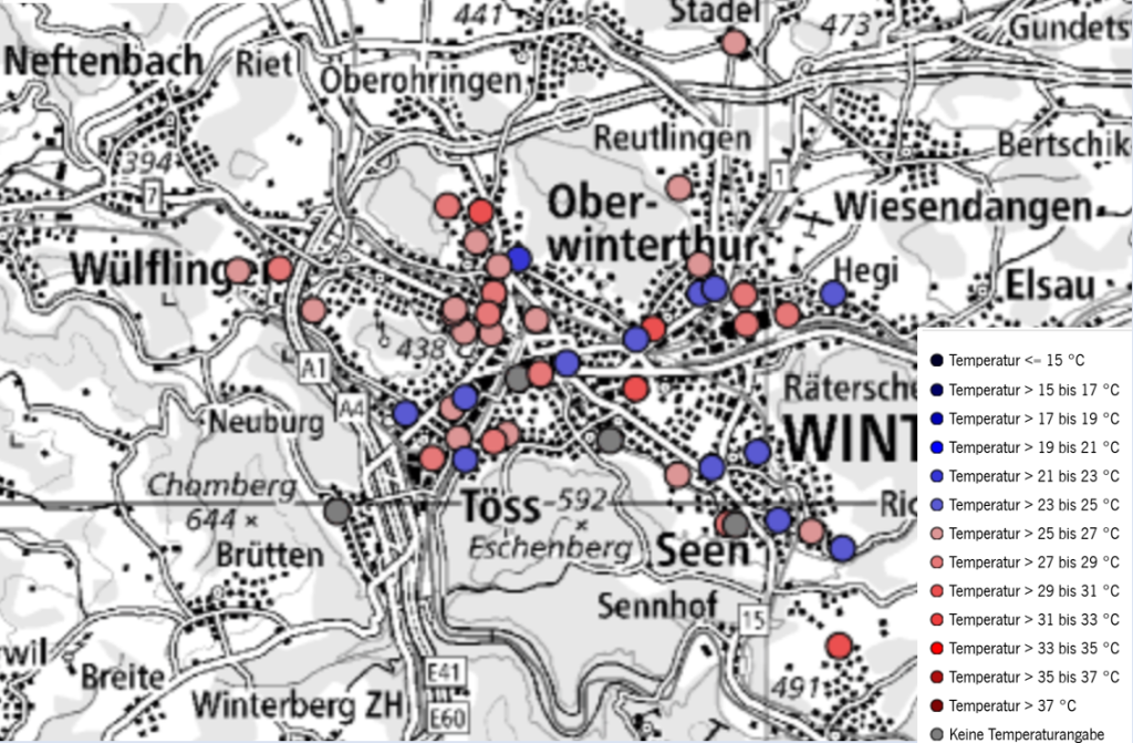
The data was submitted once a month by the participants and – after being evaluated and briefly processed by us – published on the online city map of Winterthur. To provide some useful context, metadata is available for every measurement site, such as location type (e.g. garden or balcony), orientation or environmental characteristics. Additionally, time series are available for every station. Visit the city map and have a look around!
What happens next?
The aim of this project is to study the feasability of a citizen science approach on urban climate measurements. This means that after the measurement period, we will sit down and ask critical questions about:
- the chosen infrastructure (Is the chosen measurement method appropriate? Is the data published in a reasonable way?)
- the feedback of the participants (Do people like to be involved this way? Does it improve general engagement?)
- the data quality (Can this data be used for scientific purposes?)
- future applications of the established measurement network
So you see, despite the measurements ending this month, there is still quite a lot of work to do. So stay tuned for insights in our lessons learned and (hopefully) discover the future application of this participatory measurement network.