Navigation menu
- Education
- Emissions & Air Quality
- Infrastructure & Services
- Meteorology & Climate
- News
- Physical Chemistry
- Projects
- The Team
Whereas Billy Idol enjoyed the hot summer nights in New York City, many urban dwellers nowadays wish for colder urban environments. We at ZAV investigate the urban climate and potential measures to mitigate the increasingly high temperatures within the urban heat island. Zurich’s dense urban measurement network provides an ideal dataset for comparison with and validation of modelling studies.
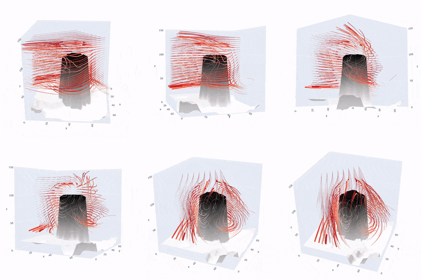
My current tool of choice is the urban Large Eddy Simulation model: PALM-4U. LES is capable to resolve the flow around buildings, even considering the buoyancy effects of hot air rising and colder, denser air sinking. This is relevant for processes such as cold air drainage from the nearby hills into the city.

Streamlines of the air circulation around a high-rise building (Hardau, ~95m). The formation of complicated flow patterns and vortices behind the building is visible. The height/z-axis is compressed.
For the event “Green Bytes – Wie grün kann Technologie sein?” of the Digitalization Initiative of the Zurich Higher Education Institutions (DIZH) we created a short animation comparing the modelled urban temperature distribution to measurements. Digital tools such as urban LES are key in evaluating urban planning and construction measures already in a planning stage; leading to better and more cost-effective outcomes.
See for yourself how well the model compares with measurements, and what we can learn from it:
Defaulttext aus wp-youtube-lyte.php
Exploring the urban climate and tackling rising temperatures in our cities is undeniably cool 😎. Kudos to ZHAW Zurich University of Applied Sciences for delving into the nitty-gritty of urban heat islands with their nifty PALM-4U model. It’s fantastic to witness the harmony between science and technology, with the animations vividly illustrating the correlation between models and real-world data. These digital tools aren’t just cutting-edge; they’re the superheroes of urban planning, leading the charge towards more comfortable and sustainable cityscapes. 🌆🌡️🏙️ #UrbanHeatSolutions